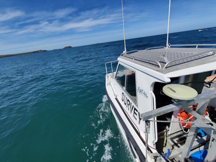
Hydrographic surveys are used to determine water depth. Soundings per square foot measure water depth. After collection, data may need to be processed, sorted, or thinned before usage. Errors, tides, and waves must also be corrected.
What is Hydrographic Surveying?
A hydrographic survey is a process that involves the measurement of the depth of a body of water. It is required for almost every construction project. It helps ships stay safe. Without accurate information on the depth of the sea, ships could be unsafe. It also provides economic benefits. For example, it allows a ship to carry a more oversized cargo by accurate depth measurement. This is vital for the safety of the ship. The process of hydrographic surveying begins with reconnaissance. The first step is the reconnaissance survey, determining the best survey methods. Then comes the exploratory survey. This is the first phase of a hydrographic survey. It is a preliminary step that collects data on sea floors, depths, and shallows. Once the results are available, the hydrographic survey can proceed to construction. The next step is determining the most suitable survey method for a specific location.
Hydrographic surveying uses an instrument to measure the characteristics of streams, lakes, and other bodies of water. Hydrographic Surveyors use the measurements to map rivers, lakes, and coastal areas. The data collected is correlated and may be presented as navigational charts, Digital Terrain Models, volume charts, or isobath plots. The accuracy of the data is essential, so errors must be corrected. The horizontal position of a surveyed point is also recorded using a Global Positioning System (GPS).
Value of Hydrographic Surveying Services
A bathymetric survey is particularly important for guiding large ships in ports and boosting Disaster Response efforts. This method of mapping the bottom of the ocean’s surface is accurate and allows you to correlate sub-bottom information with other survey methods. The method is also better than other methods, as it can be used for tidal corrections and additional data correlations. It is also possible to use bathymetry to guide large ships in a port.
As Hydrographic Surveyors, the value of hydrographic surveying services is essential. These surveys measure water depth, which is necessary for any project. You may be concerned that your project is too large or too small, but the information from hydrographic surveys is invaluable. And it doesn’t end there. A hydrographic survey is necessary for every project, whether you’re working on a large or small scale.
Hydrographic surveys are crucial for dredging, which involves the removal of rocks, mud, and other material from the bottom of a sea. This process is essential for the shipping industry, and it also helps change the drainage patterns of an area. These surveys also help in capital projects, like oil pipelines. They provide data needed for remote maintenance of oil platforms. Unlike manual checks, hydrographic surveys can help assess the water’s depth.
Hydrographic Surveying And its Significant Features.
Hydrographic surveys have several benefits. The data produced by hydrography helps update nautical charts and support port and harbour maintenance. It can also help determine fish habitats and understand marine geologic processes.
A key component of hydrographic surveys is the use of sonar. These sonar waves travel much farther in the water than radar and light waves. The data collected from hydrographic surveys are invaluable sources of information for sea level maps.
A hydrographic survey uses a series of instruments to determine the ocean’s depth. This type of survey is more costly and requires specialized training. General hydrographic surveying is a relatively straightforward method and does not require advanced skills. However, its data is often unreliable and inaccurate. Coastal engineers use this type of survey.
- Post-processing of the data. A typical hydrographic survey requires hundreds of soundings per square foot. These data may need to be thinned and corrected for errors and tides and waves before being used for construction or other purposes. Additionally, they may need to update for thermoclines and other factors.
- Wire drag surveying. The wires were attached to the stern of two boats. The weighted wires were submerged, and the boats dragged along their tracks. Today, most hydrographic surveys are done using sonar. But it doesn’t stop there. The process began with wire drag surveying, developed in the 1800s.
- Updates nautical charts. They also support coastal engineering, port and harbour maintenance, and shipwreck location. The detailed depth information obtained from hydrographic surveys is vital for understanding marine geologic processes and fisheries habitats. Many companies that conduct hydrographic surveys also make use of sonar. This type of survey uses sound waves to measure depths. Its applications range from shipping to shipwreck locations.
In conclusion
There are several types of hydrographic surveys. Hydrographic Surveyors conducting dredging projects need this information for construction and maintenance. Other types of hydrography are used for other purposes, such as in waterway planning and wreck location. The difference between these two types of surveys can be very subtle. It is possible to estimate the depth of a body of water through a gyroscope.


